FINDING BLISS IN BRITISH COLUMBIA’S BLAEBERRY VALLEY
Words and Images by Abby Cooper
With six national parks and eight provincial parks within just over an hour’s drive, Golden, British Columbia, has rightfully been dubbed the “Heart of the Parks.” But, what’s even closer than a handful of these famous parks – and equally impressive – is the Blaeberry Valley, less than 20 kilometres from downtown Golden and ripe for untamed adventures. Abby Cooper gives us the inside scoop.
A “last frontier” feel about the Blaeberry is enticing for those looking to walk their own path and enjoy an experience without encountering another soul. From roping up to conquer glaciated peaks in the Columbia Icefield to fishing with family in the valley, the Blaeberry has it all. Originally serving as a trade route by the First Nations, European Explorers later considered this route for a roadway. The valley sat somewhat dormant until the later 1900’s when much of the valley was logged. The forestry industry left behind driveable logging roads that can still take you to the doorstep of the alpine, and from there the trail is yours for the making.
After exploring the area, here’s a sampling of the activities available, but keep in mind, plenty of “make your own adventure” opportunities await!
HIKE: THOMPSON FALLS
Distance: 13km round-trip
Elevation: 85 meters
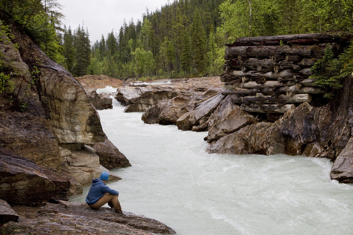
These rushing falls are adequately named after David Thompson, who utilized the pass in 1807 to successfully reach the Columbia River. The power of the Blaeberry River shows off as it enters a canyon and funnels into a waterfall before calmly dispersing with speed for the rest of its journey. Just a short 7-km drive on the Blaeberry Main Forest Service Road will bring you to the locally known “OB campground” located on the left-hand side of the road. Park your stead here and locate the trailhead. Take note: you might have to get a little crafty at times as the Blaeberry River has a mind of its own. The wild currents sometimes steal portions of the banks and higher water often hides parts of the initial trail, so be prepared to create your own trail just higher than the existing one. The majority of the hike is near the water with a small uphill that will take you out of earshot of the river before dropping you down again. The trail ends at the falls at another campsite, complete with picnic tables. If you brought a lunch to nibble, now is the time!
Love This/
With campgrounds on either end of the trail you can do the trail as a one way and shuttle, or from either campground – there and back.
Great potentially for trail-running on this route!
Consider This/
Much of the wildlife also accesses the river along the trail, so be alert.
There are rocks along the falls that make for even better viewing, but they are smooth and slippery – use caution.
HIKE: MUMMERY GLACIER
Distance: 4.5km round-trip hiking; 14km round-trip biking
Elevation: 710 meters hiking; 250 meters biking
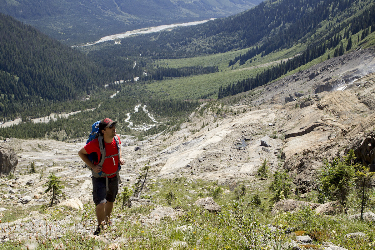
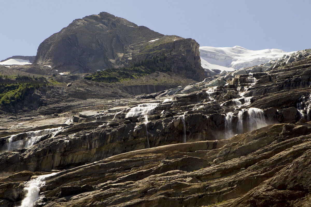
A rewarding journey to a stunning quiet location, the Mummery Glacier is a multi-sport adventure and not suited for the faint of heart. Laying eyes on a mountain painted in waterfalls, smooth unglaciated rock, and a hanging glacier above is a reward that is impossible to measure.
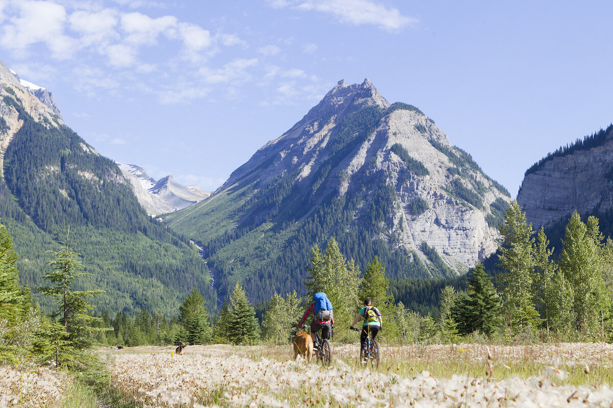
Access: Start by driving the main Blaeberry Forest Service Road (FSR) until the 28km mark (note that high clearance and 4×4 is required). The notorious flood nearly 10 years ago washed away the road and made it one with the river. Upon reaching the 28km sign, it’s time to park on the shoulder and get ready to pedal. A series of off-road trails made by ATVs hug the banks of the Blaeberry River and will wind you a few kilometres past the washout and onto a proper road again. During this section you can plan on peddling approximately 7km each way with a few “hike-a-bike” sections and potentially some wet feet. Once the side winding trails link up with the main road again, you’ll have a perfectly clear view of where you’re headed. Mummery Glacier will be in plain sight and the valley that takes you there.
Keep pedaling until you go over a bridge (last chance for water for a while if you need to top up!), take your next left onto an unnamed overgrown FSR with flagging tape. It will take you two switchbacks up and end with a cairn – a perfect bike stashing area and a trailhead sans marker. The trail is initially in the trees, offering shade and cruisy hiking speeds, but will shortly lead to another tricky river crossing. The trail takes you to where the remains of an old bridge linger; crossing here is possible but not recommended. Continue up the bank and you’ll be able to jump the water or wade through it with your shoes off, which is much easier as it is less of a canyon. You will need to back-track slightly downstream once on the other side of the bank to connect with the trail again. Here, the fastest moving trail stays in the trees and on the ridge of the moraine. It is possible and loosely marked with cairns if you prefer to walk on the rocky slope below, although it’s slippery from ground water and scorching in the heat. Both routes will lead you to a scramble on the east side of the glacier.
With glacier gear and training, it is possible to climb Mummery Mountain, however, the views of the Blaeberry, waterfalls, ice-capped mountains and utter rawness of the untouched land surrounding you will impress you from any elevation on this trail.
Love This/
Multisport adventures are that much more rewarding.
The recently unglaciated rock and still ice covered valleys above tell a story of the land.
Consider This/
This might not sound like too many kilometres for you, but it’s a big day with all that elevation and route finding. Camping via bike would be a nice change of pace.
You are extremely remote, sopacking a sat phone is great idea.
While the trail is dog-friendly, don’t let your furry friend near the ice as it is loaded in crevasses with running water behind.
HOWSE PASS
Historically speaking, this place has stories to tell, but not so much as of recent. The trail was last touched in 1993 and currently holds an “abandoned trail” status since being cut from one of the list of ‘seven mountain passes with national historic significance’ by the Monuments Board of Canada. The Ktunaxa used this pass to access Buffalo on the eastern plains of the Rockies as early as the 18th century. Following their ways, explorers used it as a trade route from Rocky Mountain House to the Columbia Valley until 1810 when the Icefields Parkway became the more favourable route of travel.
Today, travelling this pass takes some creativity, including high clearance bikes or ATVs, and highly recommended bushwhacking supplies. While the elevation gain isn’t significant, the route’s history and views are. The access starts on the same path as the Mummery Glacier, but rather than turning at the marker after the bridge as indicated, you’ll continue on the main Blaeberry FSR until reaching Cairnes Creek Recreational Site. The rec site is now abandoned, but no doubt usable. The trailhead lies just passed Cairnes Creek. This traverse is approx 60km (you tell us!) and will eventually link up with the Glacier Lake Trail that will bring you back to Banff National Park at the Saskatchewan River Crossing.
Love This/
There aren’t many places where a multi-day can mean solo adventuring. This is one of them.
It’s possible you’ll end up at the Mistaya Lodge for a cozy end to your journey.
Consider This/
You’re in wildlife territory, and they aren’t used to humans. Take all the precautions, including a sat phone, GPS and a solar charger.
CAMPING + FISHING + FORAGING
Golden locals know that the Blaeberry is a mecca for all things outdoors and this includes evening fires with family, fishing, and so much more. Before wandering out of service and into the Blaeberry, snag your BC Anglers license online and check in on the Rainbow Run regulations that pertain to the area specifically. Foraging opportunities exist at varying times throughout the warmer months if you know what you’re looking for. Most of the Blaeberry is crown land, so camping is a bit of a make-your-own and respect the land situation, but don’t shy away from the handful of established recreational sites available to you.
→ Looking for a campsite? Check out our directory of Free Camping Resources for Alberta and B.C.
A lover of all things outdoors, Abby Cooper is a splitboarder, climber, hiker, adventurer, photographer and writer. She’s living life one adventure to the next with her dog by her side.
A NOTE FROM WILDLY: You, the reader, are responsible for your own safety and gathering the information you require to tackle these trips. Please adventure safely.

